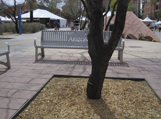
The space I chose is the alumni plaza. It is located between the administration building on the north, the mall on the south, the student union, on its’ west and modern languages to the east. Due to its location, it is a heavy traffic area. The student union is a popular place for nearly all university students and even faculty. This serves as a passing through place and also a good place to eat lunch or catch up on some homework. Therefore there is heavy traffic going north and south as well as east to west going to and from class, the mall, and the student union.
In my time observing and drawing the space, it seemed that this was indeed what people use it for. Many were eating their lunches on the steps or the lawn above, while others were doing homework in between classes. It serves as a great places for commuter students to sit between classes if they have a break, rather than going to the library or going home. As mentioned in William Whyte’s video, “The Social Life of Small Urban Spaces,” people sit where there are places to sit. That is definitely evident when looking at the Alumni plaza. The high wall with “steps” provides endless options for where and how to sit. The stairs could fit a large number of people and are big enough to leave space so that you don’t feel crowded.
Another thing people do a lot of on the lawn in the alumni plaza is to sunbathe. There were at least four girls sunbathing while I was observing, if not more. Many others may have that intention while sitting on the grass
but are less obvious about it. Those who are tanning wear shorts and tank tops and lay on the grass with their ipods, possibly even taking a nap. The elevation of the lawn means that much of the sound is drained from those passing through as the high wall creates a great sound barrier. Also those walking through don’t notice those sitting up on the grass very much.
The people who are walking typically have a specific goal in mind of where their destination is and therefore look straight ahead. Since the grass is so far up, it is less in pedestrians’ vision than those at eye level, for example, those sitting on a bench.
In my defining the space I have decided to include the three benches around the tree nearby (just on the north side). In addition to benches in this plaza there are several trashcans, which are heavily used since there is a lot of eating that occurs here.
There are an incredible number of steps to sit on, stand on, perform on, etc. The possibilities really are endless with these steps.
These are my hand drawn plan view maps:
This image points south at the top and shows the direction of traffic flow to and from mall and the student union. There are trees, rocks, cacti, benches, and trashcans. This photo focuses on the steps and pedestrian pathway down the middle. There is a bike pathway down the left side of the photo, which often causes accidents and issues between bikers and pedestrians.
This drawing showcases the benches in the bottom left of the drawing. It also points south at the top of the photo like the drawing above. Specifically it has detail in the pavers beneath the benches and large shapes show where the trashcans and trees are. Stars represent trees, which there are 3 of in this drawing, and the circles are the trashcans. On the north sides of the two large wall structures, (opposite the side of the lawn) there are several large rocks, barrel cacti, and large bush-like cacti. There are squares around the trees, which represent a change in the ground from pavers to dirt / woodchips.
This image points North at the top and shows the side with the lawn. The grass like lines represent grass and the arrows show the flow of pedestrian traffic down the middle and to the north of the lawn. In the top right are the benches, trashcans, trees, and a light post. To the south of this drawing is the UA mall.
More Information:
Ariel Photographs:
The following are Ariel Shots of the Alumni Plaza. Photo from the Hargreaves Associates website. This is the landscape architecture firm which designed the plaza.
An ariel shot from Google Images:
http://maps.google.com/mapshl=en&sugexp=gsis&pq=uofa+alumni+plaza&xhr=t&q=google+earth&cp=8&qe=Z29vZ2xlIGU&qesig=JA7iJ4T1K1DATdoSH0GjEw&pkc=AFgZ2tk6ET2kAuF1Yp43ATcrEg4QggCzVR_gzUiUL-
The location of the plaza on the University of Arizona Map
http://parking.arizona.edu/parkingmap/index.phprevNum=1&accordIndex=0&startMap=Building&mapLines=&
mapOLays=&mapMIDs=&mapZoom=15&mapLat=32.23458419463706&mapLng=-110.95024108886719


